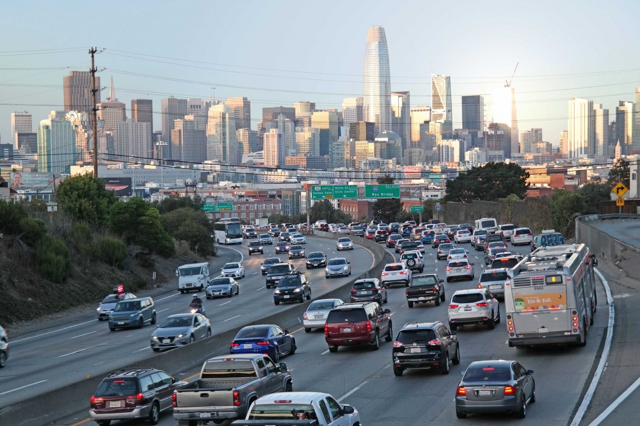
This website uses cookies and similar technologies. By using our website, closing this banner or clicking "I agree", you consent to our use of cookies. For additional details, please read our privacy policy.

I AGREE

SFCTA

Main navigation

  • Projects & Studies
    • Featured
    • Active
    • Capital Projects
    • Neighborhood Transportation Planning
    • Long-Range Planning
    • Congestion Management
    • All
  • Funding
    • Half-cent Sales Tax for Transportation
    • Prop AA Vehicle Registration Fee
    • Lifeline Transportation Program
    • One Bay Area Grant Program
    • Transportation Fund for Clean Air
    • TNC Tax
    • Funding Opportunities
  • Policies & Initiatives
    • Autonomous Vehicle (AV) Technology
    • Climate Action
    • Closing the Funding Gap
    • Complete Streets
    • Emerging Mobility
    • Equity Priority Communities
    • Neighborhood Program
    • Pricing & Incentives
    • Transit-First Policy
    • Transportation Demand Management
    • Vision Zero
  • Tools & Data
    • Maps & Data
    • Transportation Analysis Tools
  • What's Happening
    • Meetings, Agendas & Events
    • Blog
    • Press Releases
    • Stay Connected
  • About Us
    • Who We Are
    • Work with Us
    • Annual Reports
    • Governing Policies
    • Contact Us

Projects & Studies

We plan, fund, and deliver projects large and small across the city.

Select category

Grid List
Image
People walking on Clement past Green Apple bookstore

District 1 Multimodal Transportation Study

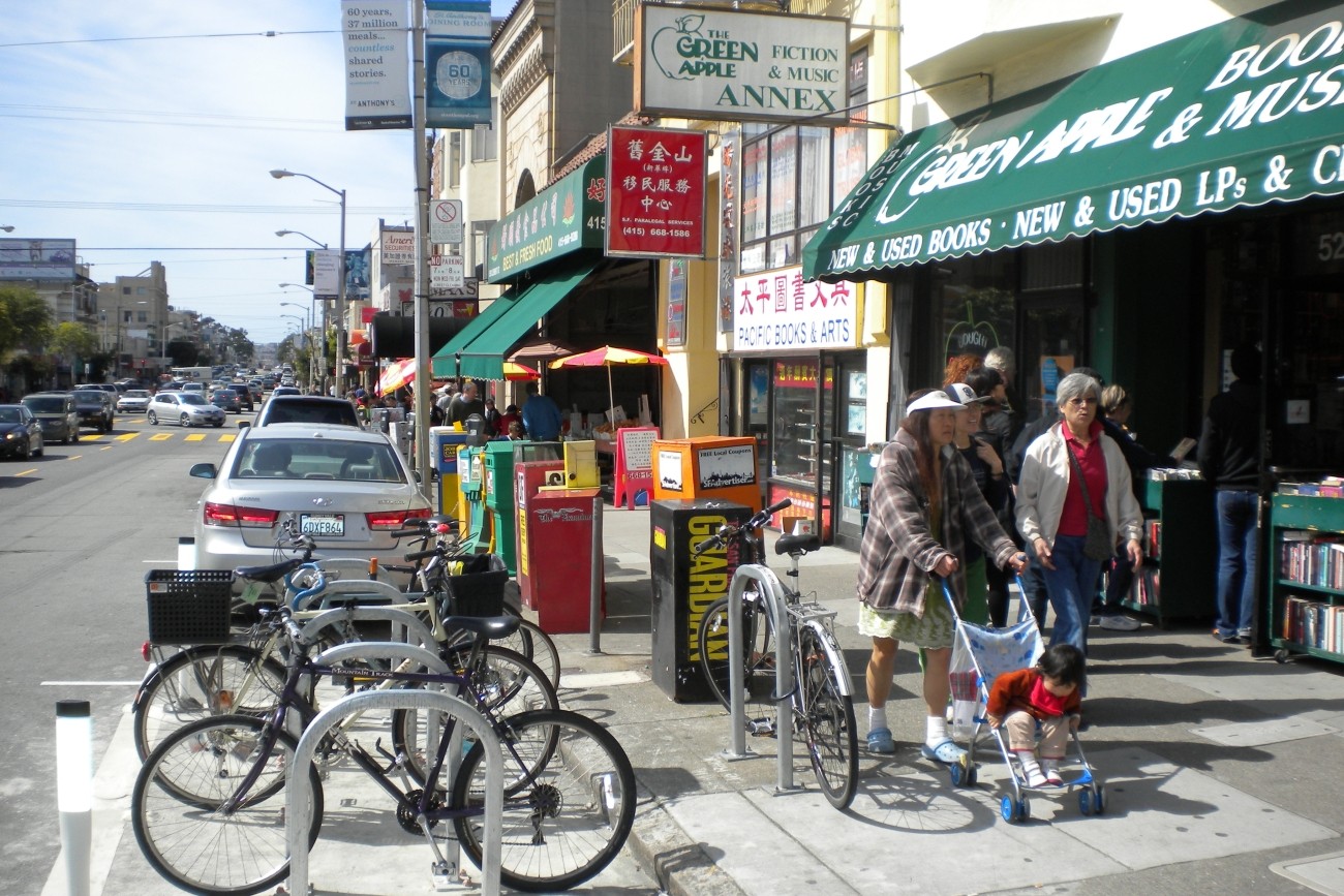
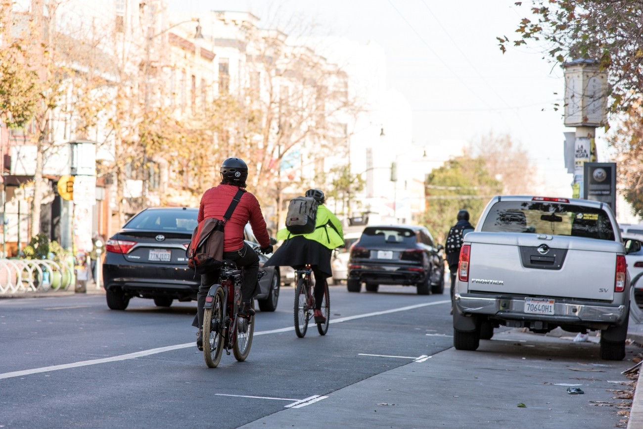
The District 1 Multimodal Transportation Study will engage the community to identify known mobility challenges and develop near- to long-term strategies to improve transit reliability and safety and shift trips to transit, walking, biking, or other non-driving options.
Image
Aerial view of Hillcrest Road Improvement Project including several surrounding projects.

Hillcrest Road Improvement Project

This project will upgrade the roadway to modern roadway and seismic standards and provide additional space for pedestrians and bicyclists.
Image
Vehicles along the I-280

I-280 Northbound Geneva Avenue Off-Ramp Study

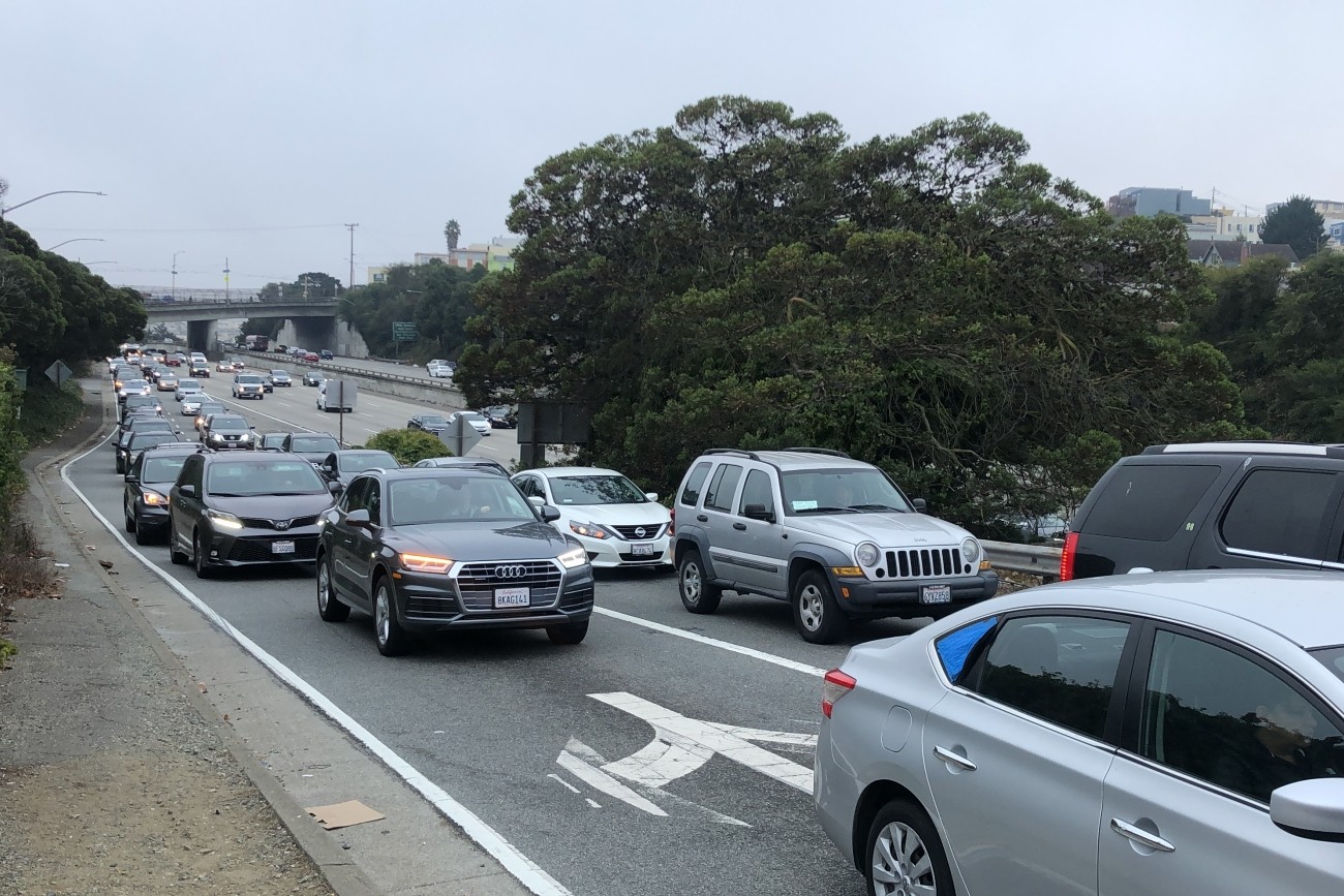
The primary objective of this study was to address safety issues at the I-280 northbound Geneva off-ramp including vehicle queues extending to the freeway mainline and related collisions. The study also explored ways to improve multimodal safety while maintaining essential transit and pedestrian movements in the area.
Image
Photo of student getting into parent's car at school

School Access Plan

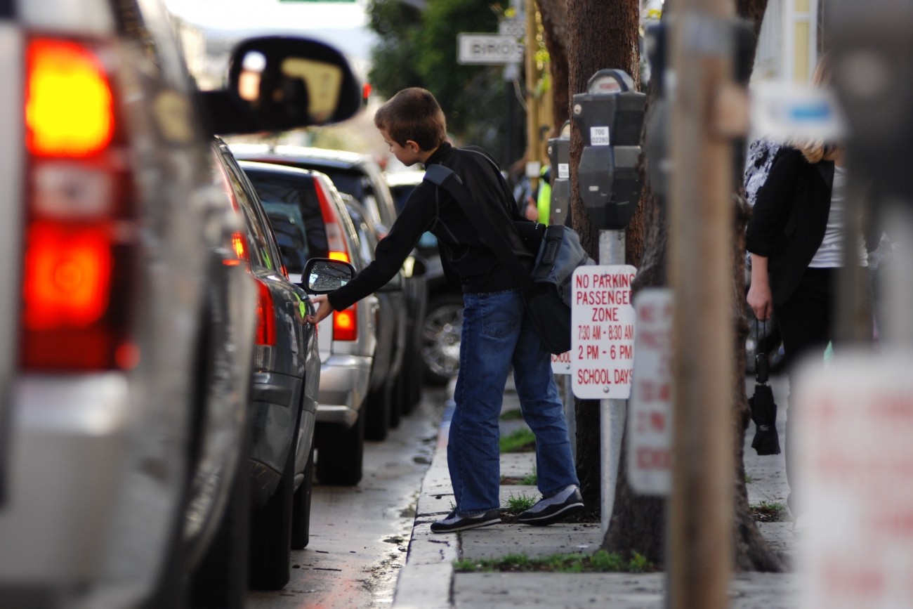
The Transportation Authority is creating a School Access Plan for San Francisco to recommend transportation solutions for K-5 students and their families.
Image
A Loop shuttle vehicle on Avenue B on Treasure Island. The San Francisco skyline is visible in the background.

Treasure Island Autonomous Shuttle Pilot

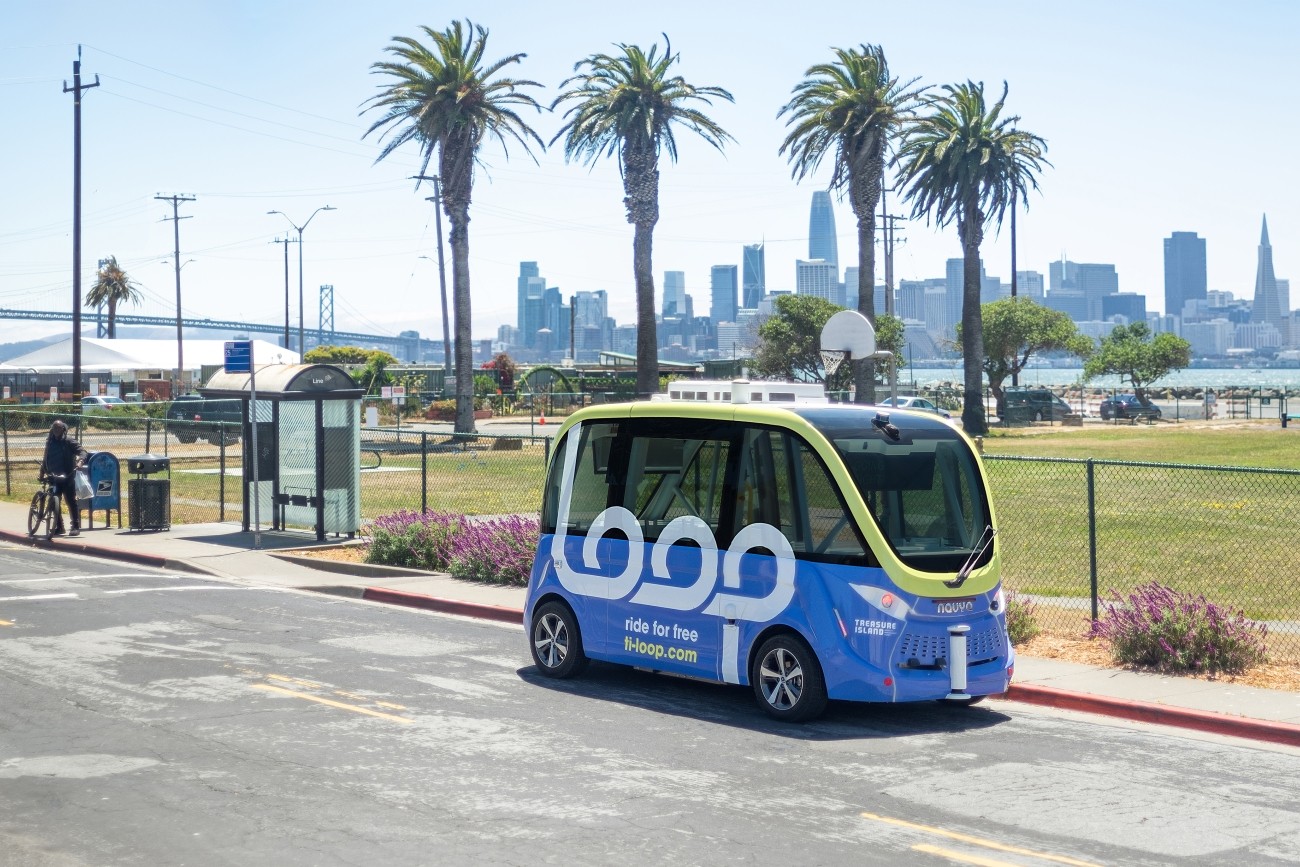
The Treasure Island Mobility Management Agency launched an autonomous shuttle service on Treasure Island from August to December 2023 to better understand how such a service could meet the needs of people traveling around the neighborhood.
Image
Street-level view of sunny Jane Warner Plaza and intersection of Market and Castro; a streetcar is turning from 17th onto Market Street.

Jane Warner Plaza Renovation Project

The Jane Warner Plaza Renovation Project will focus on improvements to pedestrian and bicycle safety in this busy multi-modal node.
Image
View of Ocean Avenue

Ocean Avenue Mobility Action Plan

The Transportation Authority developed the Ocean Avenue Mobility Action Plan to prioritize and identify funding for transportation improvements for the Ocean Avenue corridor.
Image
 Bicycle and pedestrian pathways along Hillcrest and Treasure Island Road

Yerba Buena Island Multi-Use Pathway Project

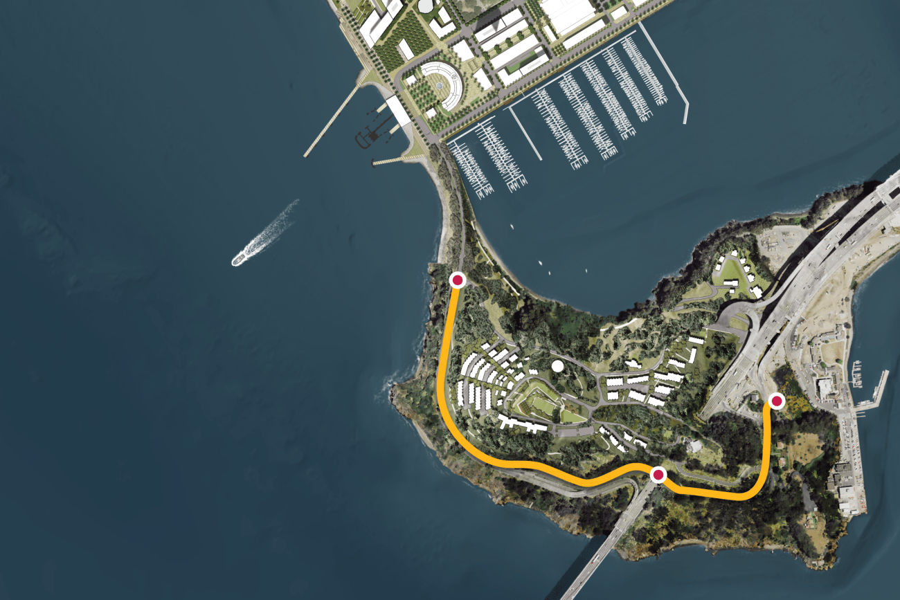
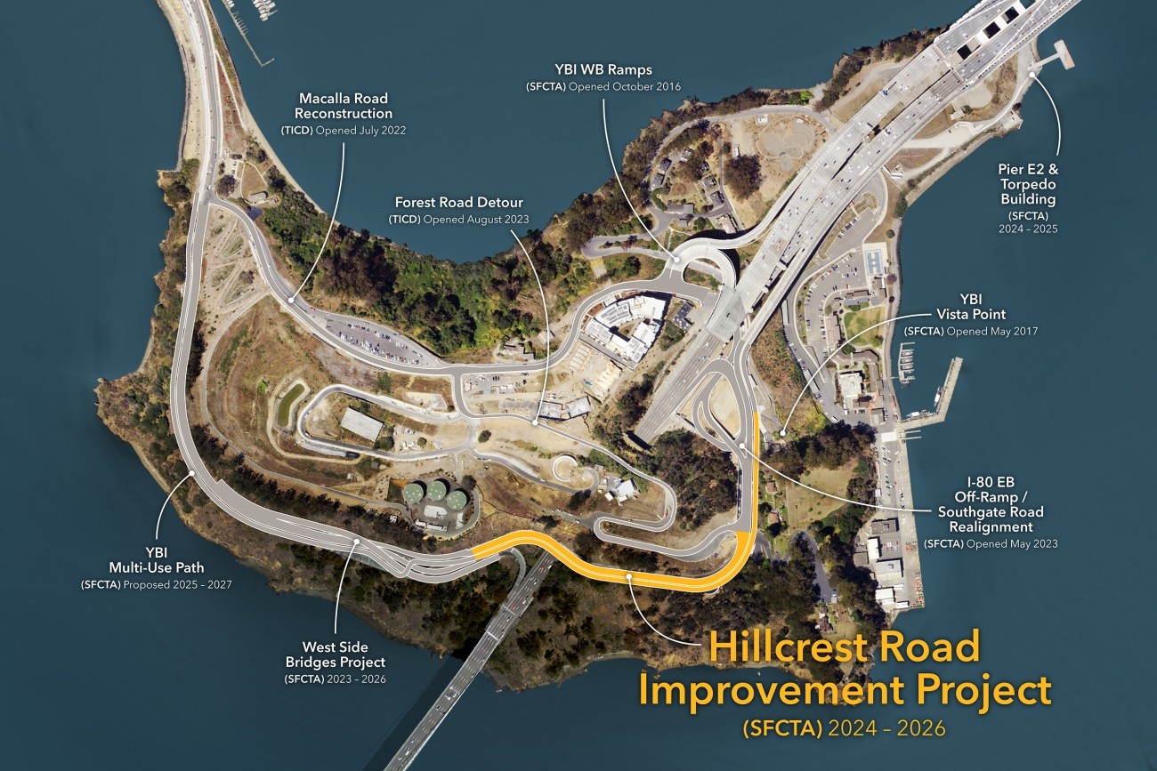
This project will provide protected bicycle and pedestrian pathways that run along Hillcrest Road and Treasure Island Road.
Image
Backlit photo of a construction worker stepping across a rebar cage.

Transportation Capital Projects Delivery Study

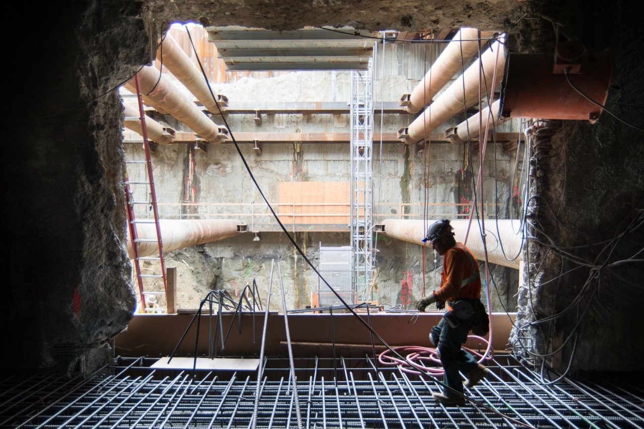
The San Francisco County Transportation Authority has released its “Transportation Capital Projects Delivery Study,” commissioned by Chair Rafael Mandelman and prior Vice-Chair Aaron Peskin to examine ways to improve delivery of large scale, complex transportation projects in San Francisco.
Image
Aerial view of Upper Market Street.

Upper Market Street Safety Improvements

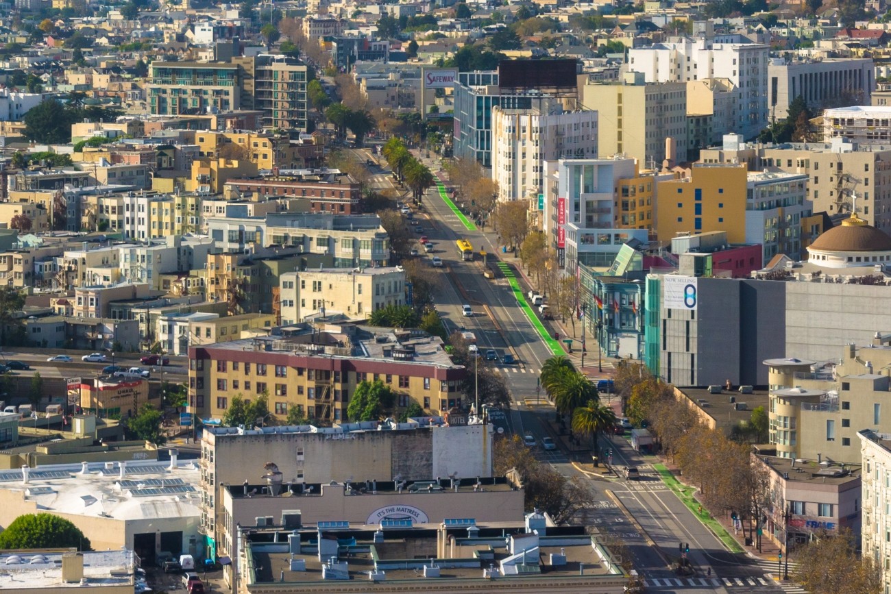
Upper Market has complex, 6-way intersections and is on San Francisco’s Vision Zero High-Injury Network. Through the Upper Market Street Safety Project, SFMTA will install sidewalk and roadway improvements to make Upper Market safer and more comfortable for people walking, biking, driving, and accessing transit.
Image
A map of the Transbay Corridor, with San Francisco on the left, Oakland and Alameda on the right, and Treasure Island & Yerba Buena Islands in the center. A yellow line with arrowheads at both ends runs along the Bay Bridge between San Francisco and Oakland.

Transbay Comprehensive Multimodal Corridor Plan Supplement

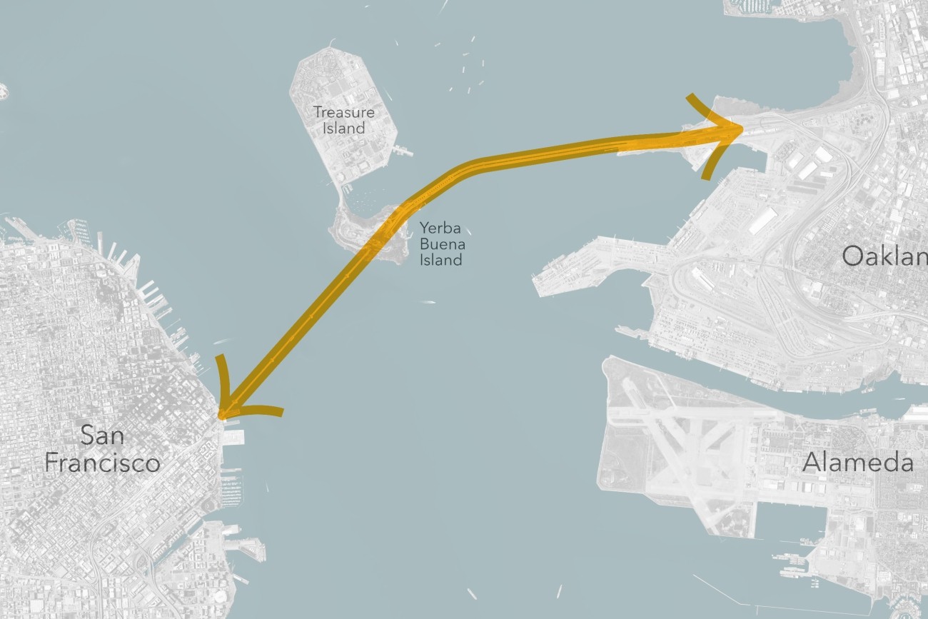
The Transbay Comprehensive Multimodal Corridor Plan Supplement presents a holistic approach for managing congestion, improving safety, and maximizing traffoc flow for all travel modes and incorporates measures to reduce air pollution and greenhouse gases.
Image
People biking on Valencia

Valencia Bikeway Improvements

The SFMTA is working with the community to assess and recommend safety improvements for Valencia Street between Market and Mission streets.
Image
Aerial view of the interchange

Alemany Interchange Improvements

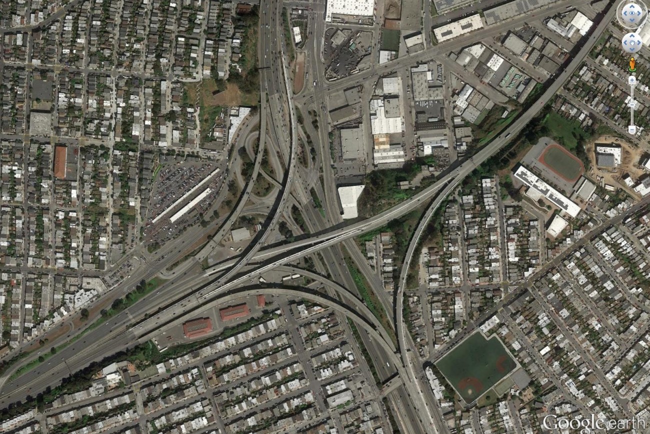
Finalized in April 2017, the Alemany Interchange Improvement Study outlined a list of safety and accessibility recommendations for the Alemany interchange.
Image
A nighttime view of the Bay including the Bay Bridge and Transamerica building

Plan Bay Area 2050

Plan Bay Area is a 25-year plan that establishes the nine-county Bay Area region’s vision for land use and transportation.
Image
People in a Chinatown crosswalk

Chinatown Neighborhood Transportation Plan

This plan focused on strategies to improve pedestrian safety on two high pedestrian-injury corridors in Chinatown: Broadway Street between Van Ness and Columbus Avenues, and Kearny Street between Bush and Jackson Streets.

Pagination

  • Previous page Previous Page
  • Page 1
  • Page 2
  • Current page 3
  • Page 4
  • Page 5
  • …
  • Next page Next page
[site.name]

Social media links

  • Follow us on Facebook Follow us on Facebook
  • Follow us on Instagram Follow us on Instagram
  • Follow us on LinkedIn Follow us on LinkedIn
  • Follow us on Twitter Follow us on Twitter
  • Follow us on YouTube Follow us on YouTube

Stay Connected

Sign up for our monthly email newsletter The Messenger, and get project-specific updates.

Sign Up

Contact

info@sfcta.org
415-522-4800

1455 Market Street, 22nd Floor
San Francisco, CA 94103
United States

View our privacy policy, sweepstakes rules, and terms and conditions.

carrot-left carrot-down arrow-right close menu download carrot-right search logo facebook twitter linkedin youtube instagram carrot-left pdf video zip