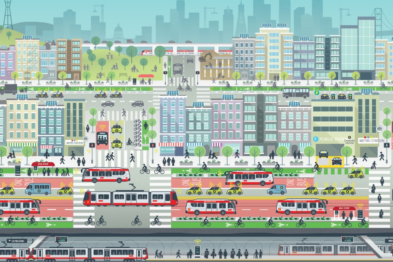
Introduction
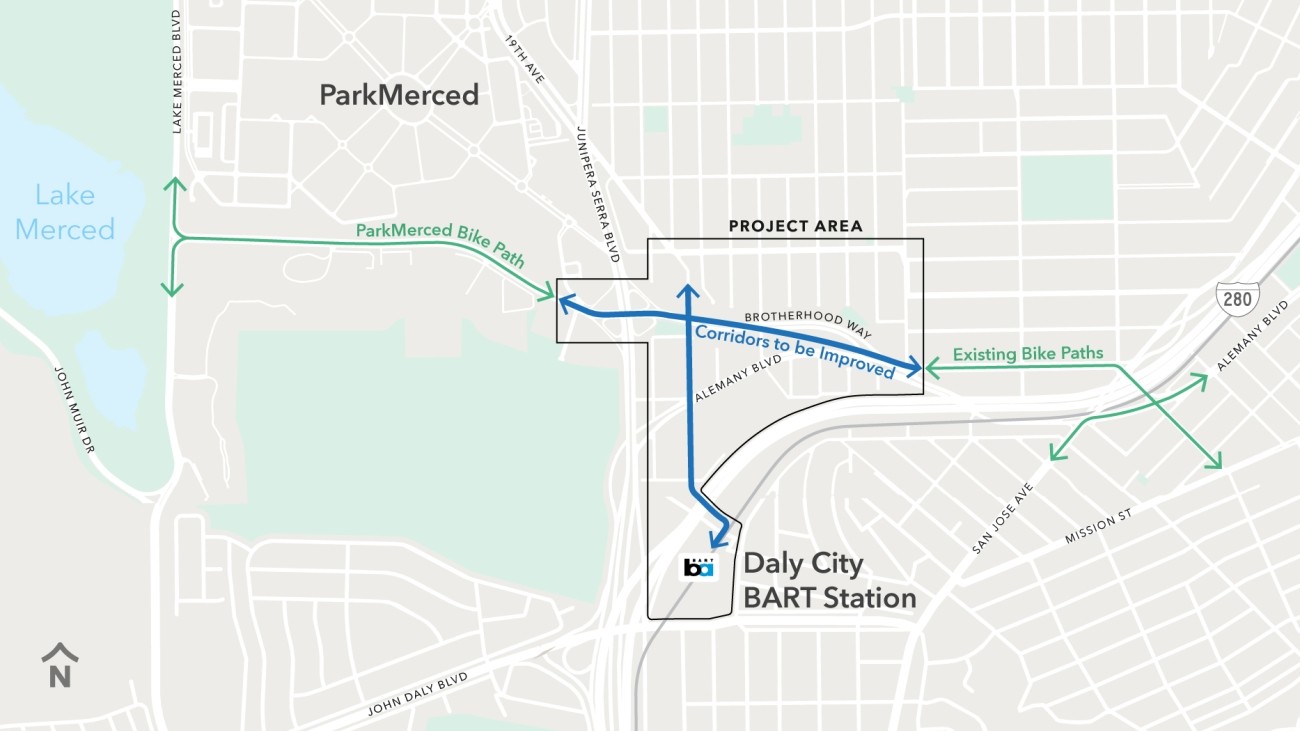
The Brotherhood Way Safety and Circulation Plan will develop near- and long-term alternatives to improve safety, circulation, and connectivity for people driving, walking, and rolling through the Brotherhood Way and Alemany Boulevard corridors as well as on surrounding streets.
ConnectSF is San Francisco’s long-range transportation planning effort. As part of ConnectSF, the 2022 Streets and Freeways Strategy (PDF) identified the Brotherhood Way and Alemany Boulevard area for future planning to address safety on high-speed, high-capacity streets and improve neighborhood connections. The Streets and Freeways Strategy includes a high-level concept for the area to inspire future planning efforts.
The Brotherhood Way Safety and Circulation Plan is the next step in the process of creating safer streets in the area. The study began with an analysis of existing conditions and a round of community outreach to identify transportation needs and confirm study goals. Potential solutions are currently being developed to address existing transportation needs challenges. These potential solutions include near- and long-term improvements.
Community engagement is a key element of each study phase, and a Community Working Group has been formed to provide input at key study junctures.
Goals
Goals for the Brotherhood Way Safety and Circulation Plan were confirmed by community members during the first round of outreach and include:
- Prioritize safety
- Improve connectivity
- Support community amenities and green space
- Prepare for the future
- Demonstrate accountability
Timeline
-
Fall/Winter 2023/24
Confirm study goals & needs. Outreach
-
Winter/Spring 2025
Develop & evaluate three sketch alternatives
-
Summer 2025
Outreach
-
Summer/Fall 2025
Refine alternatives
-
Spring 2026
Outreach: Identify preferred alternative
-
Summer 2026
Final Report
Cost and Funding
Funding for the Brotherhood Way Safety and Circulation Plan is provided by a Caltrans Sustainable Transportation Planning Grant with support from SFCTA Vice Chair Myrna Melgar and former Commissioner Ahsha Safaí.
Resources
Contact
brotherhood-way@sfcta.org
This study emerged as one recommendation from the ConnectSF Streets and Freeways Strategy, which is the city’s multi-agency long-term planning effort to build an effective, equitable, and sustainable transportation system.
This study is hoping to advance three key ConnectSF recommendations
- Prioritize safety
- Reconnect communities that are divided by freeways and large roads
- Build a complete network for walking and biking
The work will also advance recommendations from previous plans, including the Vision Zero Action Plan, BART Station Access Studies, and San Francisco’s 2009 bike plan.
2026 Outreach Events
Past Events
Round 3
The Transportation Authority hosted two town halls to present near-term and longer-term improvement concepts and learn about the community's priorities.
Round 3 Outreach Boards
- English Round 3 Outreach Board (PDF)
- Spanish Round 3 Outreach Board (PDF)
- Chinese Round 3 Outreach Board (PDF)
Round 3 Outreach Presentations
- English Round 3 Outreach Presentation (PDF)
- Spanish Round 3 Outreach Presentation (PDF)
- Chinese Round 3 Outreach Presentation (PDF)
Virtual Town Hall
Date: Thursday, April 16
Time: 5:30 p.m.
In-Person Town Hall
Date: Monday, April 13
Time: 6 to 7:30 p.m.
NEW LOCATION: 640 Palmetto Avenue, San Francisco, CA 94132
Round 2
We hosted an in-person town hall and shared an online survey during July 2025.
Online survey
Round 2 multilingual presentations
English
English Round 2 Outreach Presentation (PDF)
Cantonese
Chinese (中文) Round 2 Outreach Presentation (PDF)
Spanish
Spanish (Español) Round 2 Outreach Presentation (PDF)
Round 2 Outreach Alternatives Analysis Booklet
- Alternatives Analysis Booklet (English) PDF
- Alternatives Analysis Booklet (Spanish) PDF
- Alternatives Analysis Booklet (Chinese) PDF
Virtual Town Hall #3 (廣東話)
Note: This event was cancelled due to a lack of RSVPs.
日期: 7 月 17 日(星期四
时间:下午 5:30
In Person Town Hall
Date: Tuesday, July 15
Time: 5:30 p.m.
Location: I.T. Bookman Community Center, 446 Randolph St.
Virtual Town Hall #2 (Español)
Note: This event was cancelled due to a lack of RSVPs.
Fecha: Jueves 10 de julio
Tiempo: 5:30 p.m.
Virtual Town Hall #1 (English)
Date: Wednesday, July 9
Time: 5:30 p.m.
Round 1
The Transportation Authority worked with the community in late 2023 to draft study goals and understand key challenges near Brotherhood Way and Alemany Boulevard. The Transportation Authority convened the study’s Community Working Group in May 2024 to review findings from the first round of outreach.
Promotional poster (PDF)
Mailer sent to all addresses in Project Area (PDF)
Outreach survey (closed December 26, 2023)
Neighborhood Walk
Neighbors joined a group walking tour with others in the community to learn more about the Brotherhood Way Safety and Circulation Plan.
Date: Saturday, December 16
Time: 11:30 a.m.
Location: Entrance to Daly City BART Station (parking garage side)
500 John Daly Blvd
Daly City, CA 94014
Virtual Town Hall Meeting
Date: Wednesday, December 6, 2023
Time: 6 p.m.
- English Presentation (PDF)
- Chinese Presentation (PDF)
- Spanish Presentation (PDF)
Round 2 Outreach Alternatives Analysis Booklet
- Alternatives Analysis Booklet (English) PDF
- Alternatives Analysis Booklet (Spanish) PDF
- Alternatives Analysis Booklet (Chinese) PDF
Round 1 Outreach Findings Report
Download the Round 1 Outreach Findings Report (PDF)
We convened the study's Community Working Group in May 2024 to review the Round 1 Outreach Findings Report. Click here to download a PDF of the presentation (PDF).
Get email updates on this project
Related programs