Introduction
The Potrero Hill Neighborhood Transportation Plan developed a community-based transportation plan for the southern Potrero Hill neighborhood of San Francisco, identifying transportation priorities at the neighborhood scale.
Transportation improvement concepts explored included: neighborhood shuttle service, formalizing/supporting ridesharing, providing seating and amenities at bus stops, traffic calming streets, and upgrading existing walking paths through paving, lighting, and landscaping.
Goals
-
Enhance connectivity to daily goods and services for Potrero Terrace and Annex residents.- Create new transportation options within site
- Improve access to transportation options outside of site
- Supplement existing transit options to/from site -
Improve sense of safety and security in Potrero Terrace and Annex.Improve sense of safety and security in Potrero Terrace and Annex.
- Seek solutions that calm traffic within site
- Make transit waiting areas safer and more comfortable -
Provide short-term improvements that have independent utility before the implementation of rebuild of the site.- Develop solutions that have short lead times, low barriers to implementation, and minimal need for demolition/removal during the rebuild effort
-
Strengthen community capacity.- Complete strong community process
- Identify solutions that foster community involvement
Timeline and Status
The study’s main activities were carried out over approximately one year in 2014.
Cost and Funding
This plan was funded with a Caltrans Planning Grant and State Transit Assistance Regional Discretionary Funds for Community-Based Transportation Plans.
Project/Study Partners
BRIDGE Housing (Non-Profit Developer of Rebuild Potrero/HOPE-SF project)
California Department of Transportation*
Department of Public Health
Department of Public Works
Mayor’s Office of Housing
Metropolitan Transportation Commission*
San Francisco Municipal Transportation Agency
San Francisco Planning Department
San Francisco Recreation and Parks Department
*Denotes Funding Partner
Resources
Final Report: Potrero Hill Neighborhood Transportation Plan, 2015 (PDF)
Report Appendices (PDF)
Pedestrian Improvements
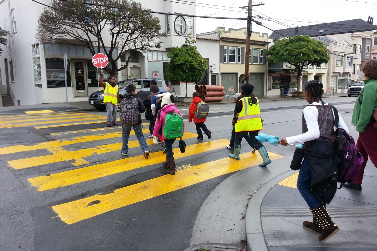
A central component of the Potrero Hill Neighborhood Transportation Plan addresses traffic calming and pedestrian realm improvements. The preliminary design for these improvements focused on five priority intersections in the Potrero Terrace and Annex site. Selected in part because they lie on the Walking School Bus routes to Daniel Webster and Starr King Elementary schools; these five intersections are critical to safe pedestrian circulation on the site. Preliminary design calls for bulb-outs and other traffic calming measures that will improve safety while reclaiming significant street space for pedestrian use. These newly reclaimed spaces will be designed by David Fletcher, a Potrero Hill-based landscape architect. Fletcher has experience with similar projects, including the design of the Persia Triangle Pavement to Parks project in the Excelsior District. In addition to smaller scale plantings, the project is expected to provide significant new garden plots. These plots will be incorporated into an existing community gardening program in Potrero Terrace and Annex.
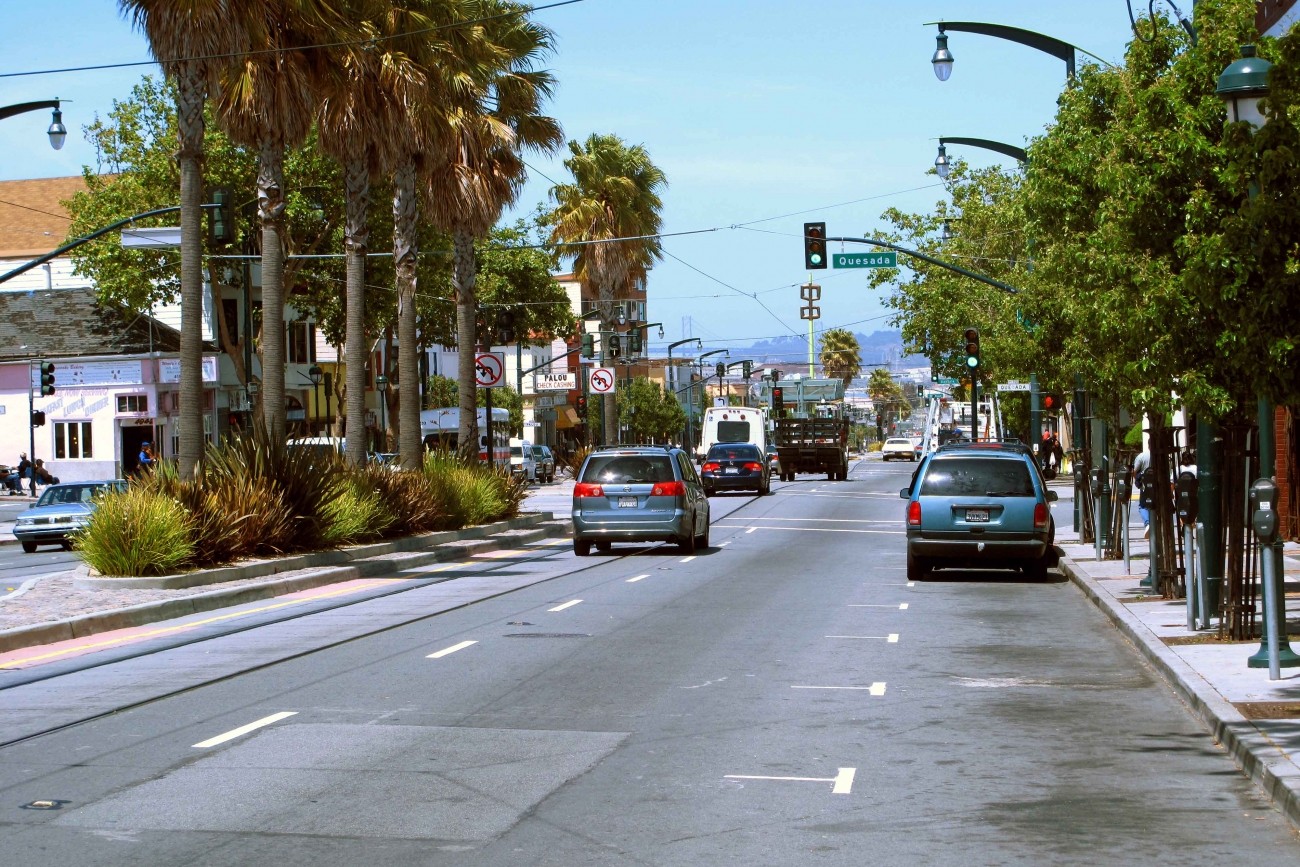
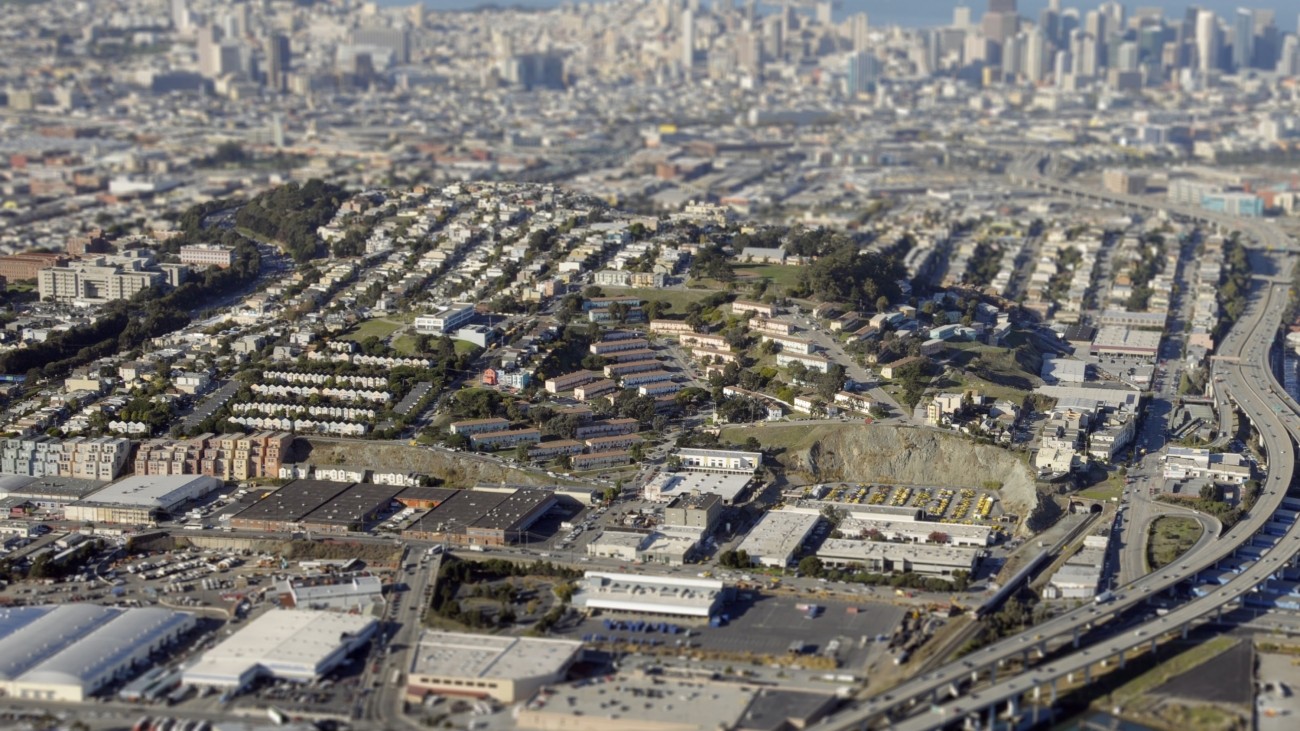
The southern Potrero Hill neighborhood includes the Potrero Annex and Potrero Terrace public housing sites, with approximately 1,200 people living in 606 homes on the steep, south-facing slope of the hill. The site is isolated, with a circuitous street grid, relatively few and challenging connections to the surrounding neighborhoods, and the I-280 and US 101 freeways forming major barriers just east and west of the sites. The sites also have notable community assets including spectacular views of the San Francisco Bay and downtown skyline, a wide array of gardens cared for by residents on-site (aided by the relatively sunny and warmer climate as compared to the rest of San Francisco), a walking school bus as part of a Safe Routes to School program, community-based organizations, the Potrero Health Clinic, and significant health and wellness programming run by BRIDGE Housing, the developer of the Rebuild Potrero project.
The Rebuild Potrero project will demolish and rebuild the site in its entirety as a mixed-use, mixed-income neighborhood, replacing all 606 public housing units, plus up to 1,000 moderate and market-rate units while also building a new grid street network. The effort is currently undergoing environmental review and seeking funding for implementation. Construction has commenced on the multi-phased project and expected to be fully completed by 2029.
The San Francisco County Transportation Authority was awarded grant funds from the Metropolitan Transportation Commission and Caltrans to lead the Potrero Neighborhood Transportation Plan. These sources intended to fund planning efforts in areas with concentrations of low-income and disadvantaged populations to support community-based planning processes. Since the housing site will be rebuilt in the medium- to long-term through Rebuild Potrero, the Potrero Neighborhood Transportation Plan provides an opportunity to identify smaller scale improvements that can improve transportation conditions for residents in the near term and support the larger rebuild effort.
The Transportation Authority project team actively conducted outreach in the Potrero Terrace and Annex community. This included a presentation and listening session at a Rebuild Potrero Meeting, which generated valuable feedback on preliminary design. In September 2014, the project team met with members of the Healthy Generations Project and the Texas Street Community Garden. The meeting was followed by a site walk and inspection of several of the targeted intersections. The team also visited the Texas Street Community Garden, a thriving garden that will expand to incorporate reclaimed street space as part of the Potrero Hill Neighborhood Transportation Plan.
Related programs