Overview
The Transportation Authority developed CycleTracks to help understand the needs of cyclists, in order to more effectively prioritize cycling infrastructure investments.
CycleTracks uses smartphone GPS support to record users' bicycle trip routes and times, and display maps of their rides, in order to help transportation planners make informed decisions about bicycle use in the community. At the end of each trip, data representing the trip purpose, route, and the date and time are sent to the Transportation Authority for analysis. All personally identifiable data are kept confidential.* The Transportation Authority—or another agency using CycleTracks—uses the data to create models that better predict where cyclists will ride and how land developments and transportation infrastructure will affect cycling in the community.
Using CycleTracks Data for San Francisco's Travel Model
Previously, San Francisco's travel model, SF-CHAMP, did not have a way of understanding the value of a bike lane versus a regular street. With the completion of the bike route choice model, official travel forecasts are able to quantify in a statistically valid way the benefit of bike infrastructure on congestion, mode share, and active travel.
Incorporating the bike route choice model into SF-CHAMP makes San Francisco one of the first cities in the world to be able to quantitatively forecast changes in travel behavior—and the effects on congestion and greenhouse-gas emissions-as a result of bicycle infrastructure investment.
Resources
A GPS-based bicycle route choice model for San Francisco, California, Transportation Letters, 2011 (PDF)
Bicycle Route Choice Data Collection using GPS-Enabled Smartphones, 2011 (PDF)
Presentation: Incorporating CycleTracks into SF-CHAMP
Presentation: Transforming CycleTracks' initial local data collection into a national effort
Contact
*We retain the iPhone's Unique Device Identifier (UDID) or Android phone's Device ID in order to group trip data by users. No other identifying information is collected except with opt-in permission. Anonymous data may be shared with other public agencies and researchers for planning purposes. We will never present anything publically that would expose your identity without your expressed permission.
Phase 1
The CycleTracks App was developed in 2009 to collect data in the San Francisco area for models that would predict what types of routes cyclists were likely to use, based on rider characteristics (e.g., level of experience) and characteristics of the bike network (hills, bike lanes, and sharrows).
How We Used CycleTracks Data
After several months of data collection, there was a sufficient amount of data to develop a bike route choice model. The results of the model development were published in the peer-reviewed journal "Transportation Letters" (PDF).
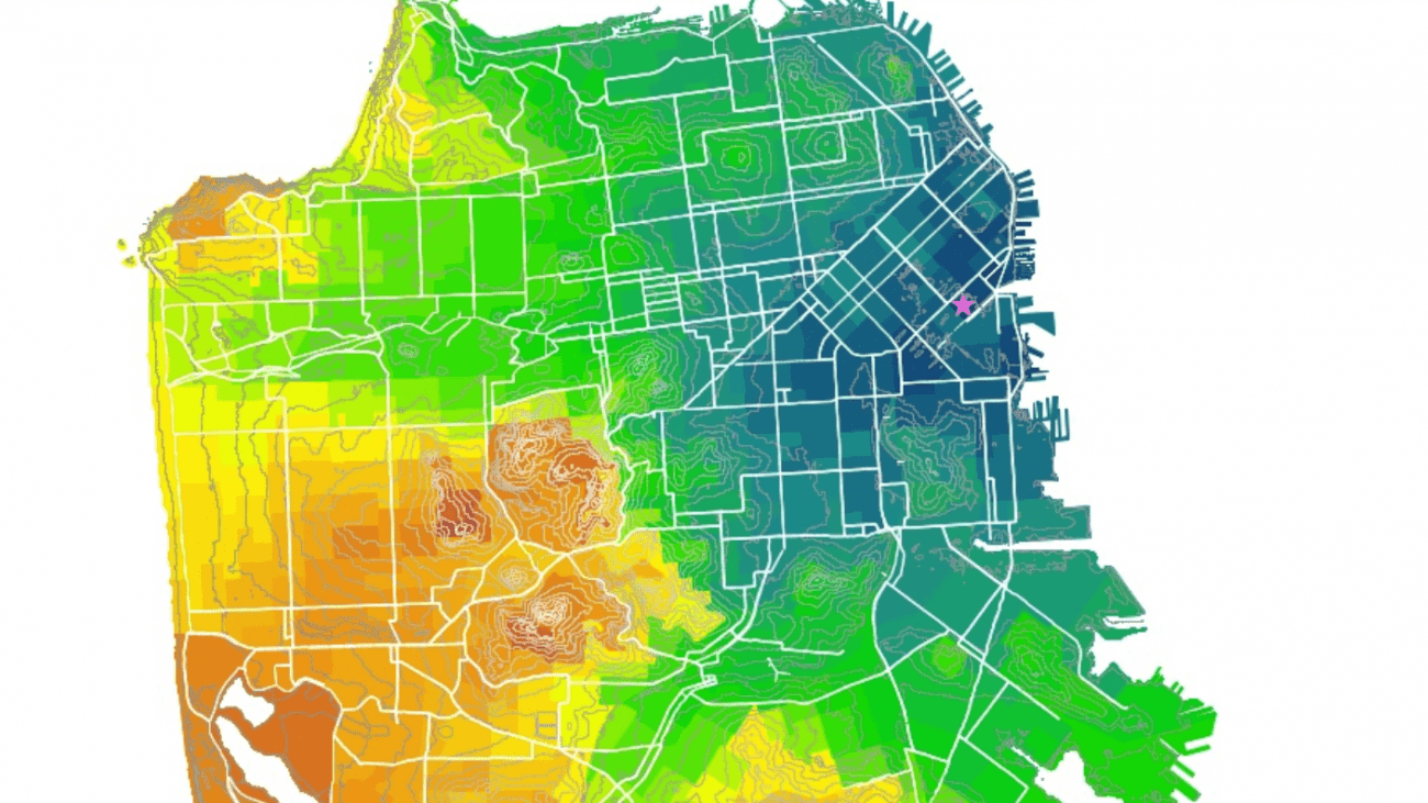
A bike route choice model shows how more or less attractive it is to bike between two points in San Francisco, based on the relative scores of a multitude of routes. The purpose of the bike route choice model is to both (1) allow planners to understand in a quantitative and statistically valid way the trade-offs that cyclists are making when they are out biking (i.e., How far away are people willing to bike for a bike lane versus a sharrow?) and (2) incorporate the value of bicycle infrastructure into the SF-CHAMP travel demand model.
What We Learned
- Roads with bike lanes feel half as far, even for frequent cyclists. In other words, frequent cyclists would equally choose a one-mile route that had bike lanes the whole way and a two mile route that did not.
- Infrequent cyclists prefer bike lanes approximately twice as much as frequent cyclists.
- Cyclists who aren't commuting are willing to bike out of there way one mile for every 100 feet of hill rise. The several hundred feet of hills avoided by taking "The Wiggle" feel like you've saved miles.
- Commuters are more than three times as likely to go out of their way to avoid hills.
- Bike route or sharrows have a marginal impact on the perception of one's bike route. Cyclists are willing to go out of their way by almost 10 percent in order to use them, but infrequent cyclists don't prefer them more in any statistically significant way.
- The model even revealed the value of routes such as "The Wiggle" by demonstrating the distance people were willing to bike out of their way, rather than take more direct routes over nearby hills.
Since the initial project's success in 2010, a number of other agencies and municipalities have begun using CycleTracks to understand the needs of cyclists. As of August 2012, 4,365 users have submitted trips. Fourteen percent of users have submitted 10 or more trips.
Both the application (iPhone and Android versions) and the bike route choice model are open source and available on Github to fork and rebrand. We have also made the (anonymized) data collected via the CycleTracks available to public agencies who wish to publicize the original application without reworking it, which allows agencies and researchers across the country to replicate and build on what we've done.
Cities collecting data with CycleTracks
- Austin, TX
- Monterey, CA
- Raleigh, NC
- Fort Collins, CO
- Minneapolis/St. Paul, MN
- Seattle, WA
- Salt Lake City, Utah
- Los Angeles, CA
- Toronto, Ontario
- Lexington, KY
CycleTracks rebranded and improved by other cities
- Lane County, OR (LaneTracks)
- College Station, TX (AggieTracks)
- Charlottesville, VA (C-Vill Bike mAPP)
- Hampton Roads, VA
- Atlanta, GA (Cycle Atlanta)
- Montreal, Quebec (My ResoVelo)
- Reno, NV (RenoTracks)
- Philadelphia, PA (CyclePhilly)
Other derivative products
- PaceLogger (Developed by nustats.com and available on the iTunes store.)
Source Code
If you are a developer interested in creating mobile apps based on the CycleTracks source code, you can browse or fork the code for iPhone or Android. We encourage you to find great ways to build on it. You can also see an initial version of our bike route choice model.
Note that the source code is licensed under the Gnu GPL license version 3, which means you must provide the source code to any changes you distribute.
Contact
Interested in using CycleTracks in your city? Email cycletracks@sfcta.org.